 SNOWO
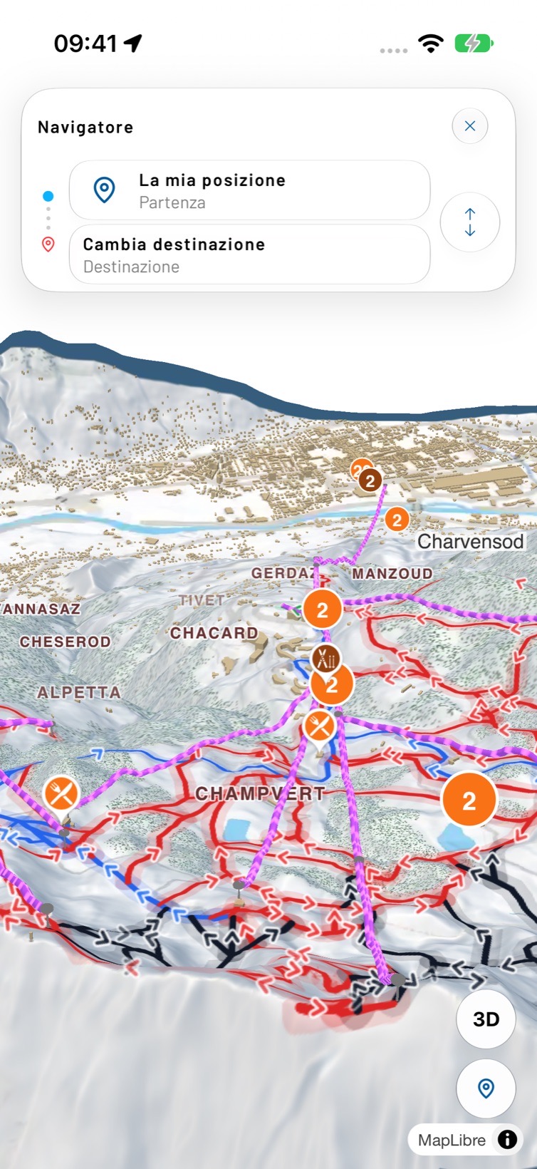
3D maps · offline
The mountainin 3D.
Real terrain, runs coloured by difficulty, lifts and huts. Download the map before you go up and it works with no signal.
01Offline
Download
before you go.
Up high the signal comes and goes. Download the map in the valley: runs, lifts and navigation stay available even in airplane mode.
The map works without a connection.
02Ski area
Every run
has a name.
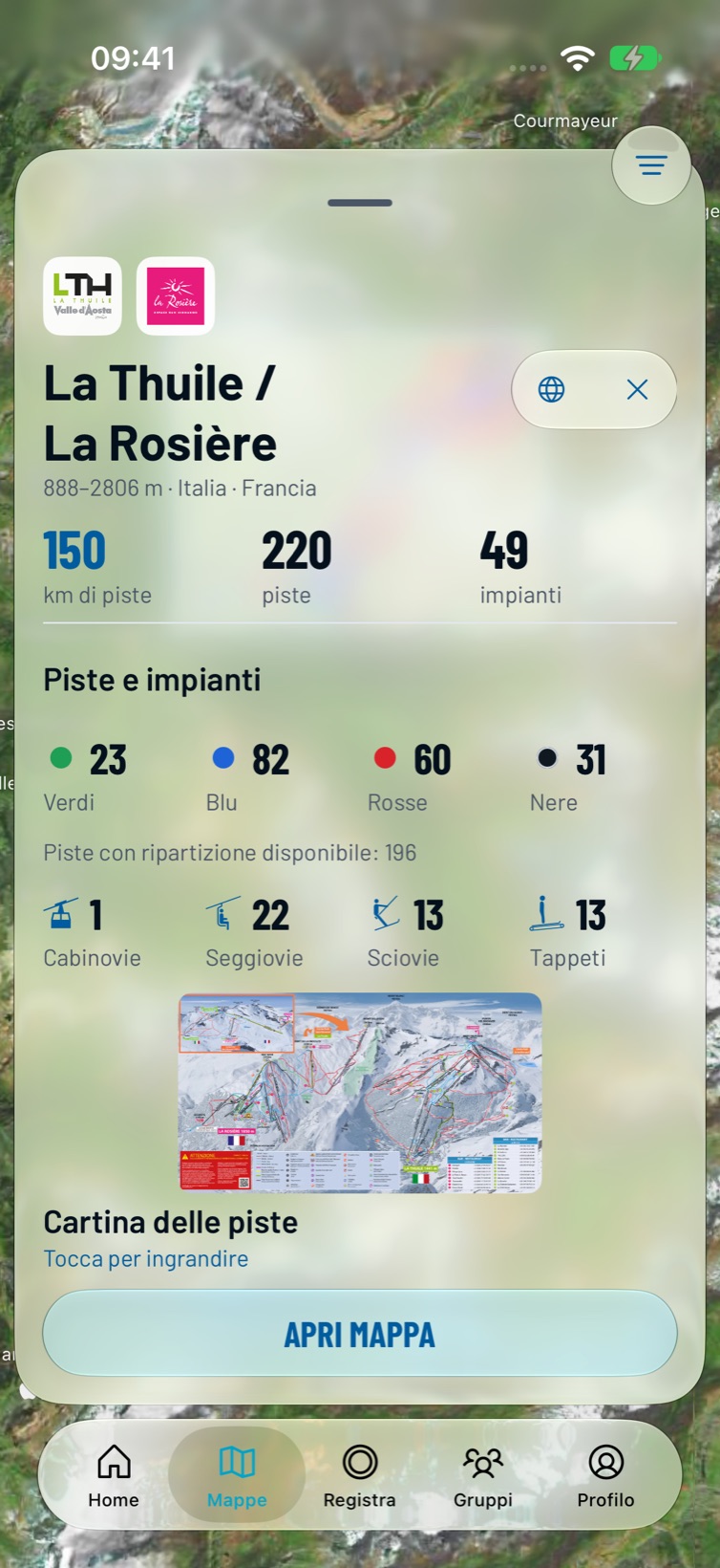
For each ski area: kilometres of runs, runs by colour, lifts by type and the official piste map. Search a run, a lift or a hut by name.
- SearchRuns, lifts or places by name
- Piste statusOpen and closed where the resort publishes it
- Official mapThe resort’s piste map at your fingertips
- CorrectionsReport a wrong detail and the map gets better
03Ski areas
Six live
maps.
The first maps are in the Alps across Italy, France and Switzerland. More are coming: if yours is missing, you can request it in the app.
Your next run
starts here.
Snowo is in beta on TestFlight for iPhone. Leave your email and where you ski: we send the invite as soon as there is room. On Android we let you know at launch.